Why Boundary Survey Accuracy Is Critical for Texas Subdivision Projects
Subdivision development in Texas is growing rapidly due to increasing residential, commercial, and mixed-use development projects. However, one of the most important yet often underestimated aspects of any successful subdivision project is boundary survey accuracy.
Accurate boundary surveys form the foundation of land development planning, engineering design, permitting, legal compliance, and construction execution. Even a small boundary discrepancy can lead to costly legal disputes, project delays, redesign issues, permit complications, and financial losses.
For developers, civil engineers, land planners, and survey professionals, investing in accurate boundary survey services is essential for ensuring the long-term success of subdivision projects in Texas.
What Is a Boundary Survey?
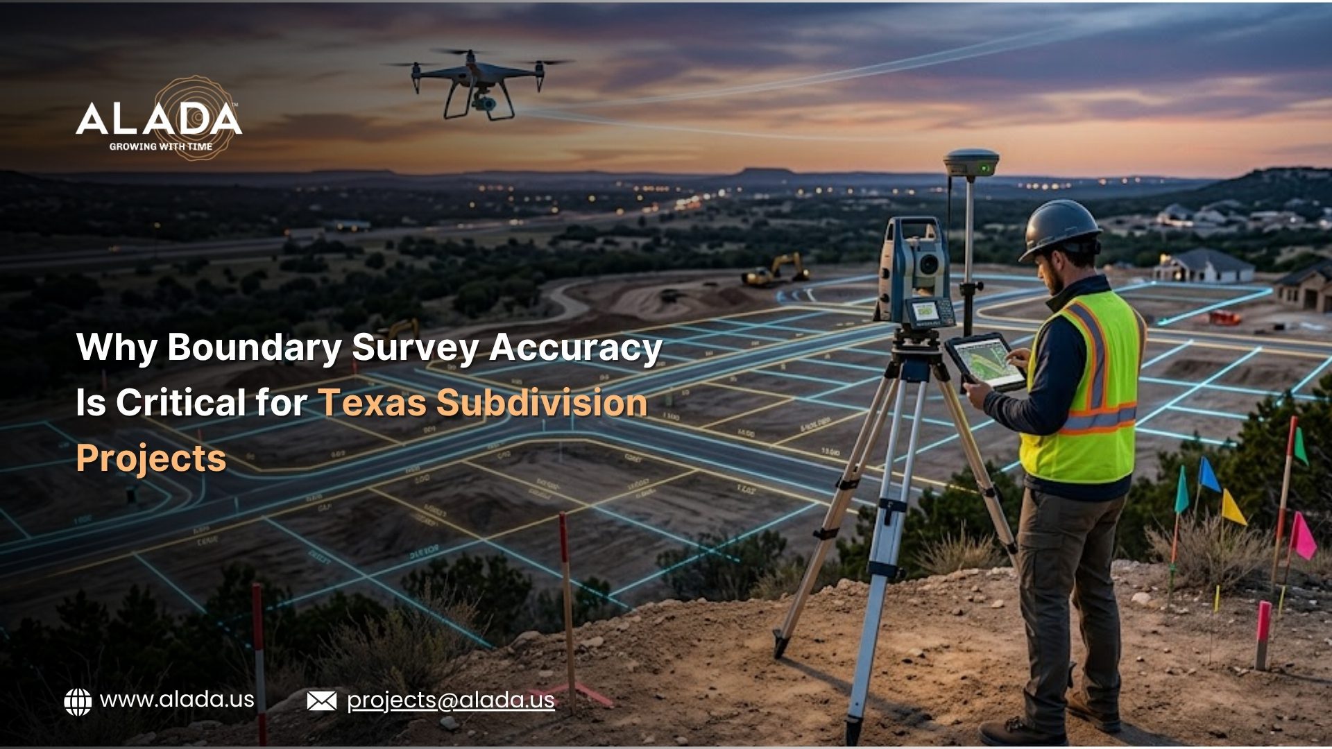
A boundary survey is a professional land surveying process used to identify, establish, and document the legal property boundaries of a parcel of land. Licensed land surveyors use historical property records, deeds, plats, easements, field measurements, and advanced surveying technologies to determine precise property lines.
Boundary surveys are commonly required for:
• Subdivision development
• Land acquisition
• Property disputes
• Site planning
• Construction projects
• Permit approvals
• Utility planning
• Real estate transactions
• Infrastructure development
For Texas subdivision projects, accurate boundary data is critical because every stage of development depends on precise land measurements.
Why Boundary Survey Accuracy Matters for Texas Subdivision Projects
Texas subdivision projects depend heavily on precise land measurements and legal property data. Even minor boundary survey errors can create major issues during planning, permitting, and construction.
Prevents Property Disputes
Accurate surveys help developers avoid encroachments, ownership conflicts, and legal disputes with neighboring properties.
Supports Efficient Subdivision Planning
Boundary surveys help engineers and planners design compliant lot layouts, road alignments, utility corridors, and setback requirements.
Reduces Delays and Compliance Risks
Precise survey data supports permit approvals, utility coordination, and smoother construction execution while minimizing costly redesigns.
Common Problems Caused by Inaccurate Boundary Surveys
Boundary survey errors can create serious operational and financial challenges for subdivision projects.
Encroachment Issues
Incorrect property lines may cause buildings, roads, or utilities to extend into neighboring properties.
Permit Delays
Municipal authorities may reject subdivision plats with inaccurate boundary information.
Legal Disputes
Property conflicts can lead to expensive legal proceedings and development delays.
Utility Placement Errors
Improper survey data can affect utility corridors and infrastructure installation.
Increased Project Costs
Survey inaccuracies often result in redesign expenses, construction modifications, and additional engineering work.
Technologies Improving Boundary Survey Accuracy in Texas
Modern surveying technologies are helping improve precision, efficiency, and reliability for subdivision projects.
GPS and GNSS Surveying
Advanced GPS and GNSS systems provide highly accurate positioning data for land measurements.
Drone Surveying
Drone technology helps capture aerial mapping data quickly and efficiently for large subdivision sites.
LiDAR Scanning
LiDAR technology improves terrain modeling and site analysis accuracy.
GIS Mapping
Geographic Information Systems (GIS) help organize and visualize survey data effectively.
CAD Drafting and Digital Mapping
Digital drafting solutions improve boundary documentation and engineering coordination.
Using advanced surveying technologies helps reduce errors and improve project planning accuracy.
Importance of Boundary Surveys in Texas Land Development
Texas continues to experience significant growth in:
• Residential communities
• Commercial developments
• Industrial parks
• Mixed-use projects
• Infrastructure expansion
As land values increase, accurate boundary surveying becomes even more important for reducing development risks.
Developers require precise survey data to ensure:
• Legal compliance
• Project feasibility
• Efficient subdivision layouts
• Infrastructure coordination
• Successful permit approvals
Boundary survey accuracy directly impacts the overall success of subdivision projects.
Key Elements Included in a Boundary Survey
A professional boundary survey for subdivision development typically includes:
• Property line identification
• Easement locations
• Existing improvements
• Encroachments
• Right-of-way details
• Legal descriptions
• Survey monuments
• Lot dimensions
• Utility easements
• Adjoining property information
Comprehensive survey documentation supports smoother development planning and approval processes.
How Accurate Boundary Surveys Support Civil Engineering Services
Civil engineering teams rely heavily on precise survey data for land development projects.
Boundary surveys support:
• Grading design
• Drainage planning
• Utility design
• Roadway layouts
• Stormwater management
• Site development plans
• Infrastructure coordination
Without accurate survey information, engineering designs may require revisions later in the project lifecycle.
Why Developers in Texas Need Professional Survey Support
Subdivision projects involve multiple stakeholders, including:
• Developers
• Surveyors
• Civil engineers
• Municipal authorities
• Utility providers
• Construction teams
Accurate survey coordination ensures all project teams work with consistent and reliable land data.
Professional survey support helps developers:
• Reduce project risks
• Improve planning efficiency
• Accelerate approvals
• Minimize costly mistakes
• Enhance project profitability
Why Choose Professional Survey Drafting and Land Development Support?
Modern subdivision projects require more than traditional surveying methods. Developers increasingly depend on integrated land development support services, including:
• Survey drafting support
• CAD mapping
• Civil engineering drafting
• Geospatial data processing
• Utility coordination
• Site development planning
Efficient drafting and survey support improve communication between development teams and help accelerate project timelines.
How Alada Solutions Supports Texas Subdivision Projects
Alada Solutions provides professional land development and survey drafting support services for engineering firms, survey companies, and subdivision development projects.
Our services help clients improve project accuracy, streamline workflows, and support efficient land development planning.
We provide:
• Land survey drafting support
• CAD drafting services
• Geospatial post-processing support
• Civil engineering drafting
• Land development design support
• Utility coordination drafting
• GIS mapping services
• Infrastructure drafting support
Our team supports accurate documentation and efficient project coordination for complex subdivision developments.
Benefits of Outsourcing Survey Drafting Support for Texas Projects
Engineering and surveying firms can improve efficiency by outsourcing drafting and survey support tasks.
Benefits include:
• Faster project turnaround
• Reduced operational costs
• Improved drafting accuracy
• Access to skilled CAD professionals
• Scalable project support
• Better resource management
Outsourcing support services helps firms focus on field operations, client communication, and project management.
Future of Boundary Surveying in Texas
The future of boundary surveying is becoming increasingly technology-driven.
Emerging technologies such as:
• AI-powered mapping
• Drone surveying
• Cloud-based collaboration
• LiDAR scanning
• Digital twins
• GIS integration
are improving surveying accuracy and project efficiency.
As subdivision development continues to expand across Texas, accurate boundary surveying will remain a critical factor in successful land development projects.
Conclusion
Boundary survey accuracy plays a vital role in the success of Texas subdivision projects. Accurate surveys help prevent legal disputes, improve subdivision planning, support permit approvals, reduce construction risks, and enhance overall project efficiency.
For developers, engineers, and survey professionals, investing in precise survey data is essential for minimizing costly errors and ensuring smooth project execution.
As Texas land development projects continue to grow in complexity, professional survey drafting and land development support services are becoming increasingly important.
Alada Solutions provides reliable survey drafting and land development support services to help engineering and surveying firms improve project accuracy and operational efficiency.
Contact Us
Looking for professional survey drafting and land development support services for your Texas subdivision projects?
• Improve boundary survey documentation
• Streamline land development workflows
• Enhance drafting accuracy
• Support faster project delivery
Connect with Alada Solutions to discuss your project requirements.