

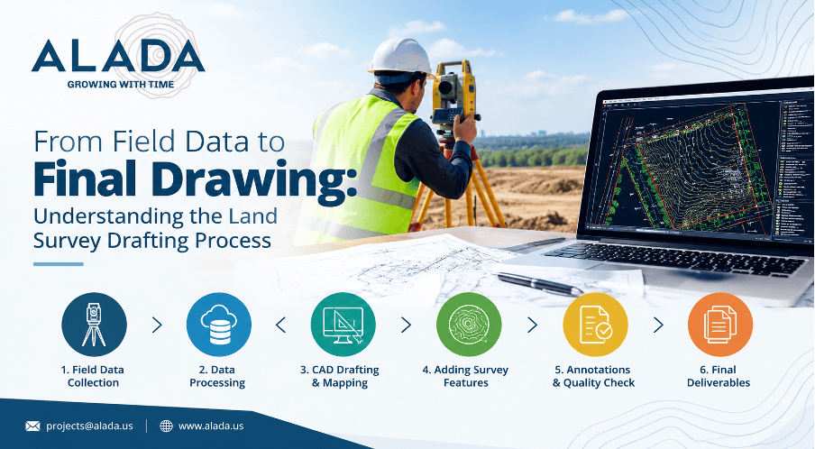
From Field Data to Final Drawing: Understanding the Land Survey Drafting Process
Accurate land survey drafting is an essential part of property development, construction, infrastructure planning, and real estate due diligence. While field surveyors collect measurements and site information, land survey drafting converts that raw survey data into clear, accurate, and usable drawings.
For U.S. projects, properly prepared survey drawings can help surveyors, engineers, architects, developers, and contractors understand property boundaries, existing site conditions, elevations, utilities, structures, and other critical features.
What Is Land Survey Drafting?
Land survey drafting is the process of transforming field-collected survey data into detailed digital drawings using CAD, Civil 3D, and related drafting technologies.
The drafting process may include:
• Property boundaries
• Existing buildings and structures
• Roads and driveways
• Topographic features
• Contours and elevations
• Utilities
• Easements and rights-of-way
• Trees and site features
• Survey points
• Parcel information
• Labels and annotations
• Dimensions and bearings
• Legal descriptions and other survey information
The final drawing provides a structured representation of the surveyed property that can be used for planning, design, permitting, construction, and documentation.
How Does the Land Survey Drafting Process Work?
The process generally moves through several stages, from field data collection to final quality-checked drawings.
1. Field Data Collection
The process begins with the collection of accurate site data by professional survey teams.
Depending on project requirements, surveyors may use:
• Total stations
• GNSS/GPS equipment
• Digital levels
• 3D laser scanning
• Drones and photogrammetry
• Other surveying technologies
The collected information may include coordinates, elevations, property corners, structures, utilities, roads, vegetation, and other physical features.
Accurate field data is the foundation of an accurate survey drawing.
2. Survey Data Processing
After fieldwork, the collected data is organized and processed before drafting begins.
Survey data may contain:
• Point numbers
• Coordinates
• Elevations
• Descriptions
• Breaklines
• Field codes
• Control points
The drafting team reviews the available information and prepares it for CAD-based mapping.
This stage helps identify inconsistencies or missing information before the final drawing is developed.
3. CAD Drafting and Mapping
Processed survey information is then imported into AutoCAD, Civil 3D, or other appropriate CAD platforms.
The drafting team creates the base drawing and organizes survey information into appropriate layers.
Depending on the project, the drawing can include:
• Boundary lines
• Existing conditions
• Topography
• Contours
• Buildings
• Roads
• Utilities
• Drainage features
• Fences
• Trees
• Easements
• Right-of-way information
Proper layer organization makes the drawing easier for engineers, architects, surveyors, and other project professionals to use.
4. Adding Survey Features and Site Information
Once the basic drawing is established, additional survey features are incorporated based on the project requirements.
For example, a topographic survey drawing may include spot elevations, contours, drainage structures, surface features, and existing improvements.
A boundary survey may focus more heavily on property lines, monuments, bearings, distances, easements, and related boundary information.
For projects requiring ALTA/NSPS surveys, the drafting workflow must accommodate the applicable survey requirements and Table A items specified for the project.
The final drawing should clearly communicate the information required by the surveyor and intended project users.
5. Annotations and Quality Checking
Drafting is not simply about placing survey points on a drawing. The information must be presented clearly and consistently.
Quality control can include checking:
• Dimensions
• Bearings and distances
• Elevations
• Labels
• Layer standards
• Linework
• Symbols
• Scale
• Text placement
• Title blocks
• North arrows
• Survey notes
• Coordinate information
• Drawing references
A structured quality-check process helps reduce drafting errors and unnecessary revisions.
6. Final Survey Drawing Deliverables
After drafting and quality checking, the completed survey drawing can be prepared according to the project requirements.
Common deliverables may include:
• DWG files
• PDF survey drawings
• CAD base files
• Topographic survey drawings
• Boundary survey drawings
• ALTA/NSPS survey drafting
• As-built survey drawings
• Utility survey drawings
• Construction survey drawings
The exact deliverables depend on the scope, surveyor requirements, project standards, and intended use.
Types of Land Survey Drawings
Different projects require different types of survey drawings.
Boundary Survey Drafting
Boundary survey drafting represents property boundaries, monuments, dimensions, bearings, easements, and other relevant property information.
Topographic Survey Drafting
Topographic drafting focuses on the existing physical characteristics of a site, including elevations, contours, structures, roads, drainage features, and other improvements.
ALTA/NSPS Survey Drafting
ALTA/NSPS survey drafting is commonly used for commercial real estate transactions and due diligence. Drawings are prepared based on the applicable survey requirements and project specifications.
As-Built Survey Drafting
As-built survey drawings document constructed conditions and can help project teams compare completed work with design or approved plans.
Utility Survey Drafting
Utility survey drafting represents available information about above-ground and underground utility features based on the survey data and project scope.
Why Accurate Land Survey Drafting Matters
Accurate drafting can support several stages of a development or construction project.
Better Project Planning
A clear survey drawing gives engineers and designers reliable existing-condition information to work from.
Fewer Design Errors
Organized and accurately drafted survey information can help reduce conflicts between existing site conditions and proposed designs.
Faster Engineering Workflows
Civil engineers and designers can use properly structured CAD files as a base for site development and design work.
Improved Coordination
Survey drawings provide a common reference for surveyors, civil engineers, architects, developers, and contractors.
Support for Permitting and Development
Depending on project requirements, survey information may be needed for planning, design, permitting, property evaluation, and development documentation.
Land Survey Drafting vs. Land Surveying
These two services are closely connected but are not the same.
Land surveying involves collecting and establishing information about a physical property through professional field and surveying procedures.
Land survey drafting involves converting the collected survey information into organized technical drawings.
In simple terms:
Field Survey → Survey Data → Data Processing → CAD Drafting → Quality Check → Final Drawing
The quality of the final drawing depends heavily on the accuracy and completeness of the underlying survey information and the drafting workflow.
Why Outsource Land Survey Drafting?
U.S. surveying and engineering firms may outsource drafting when they need additional production capacity, specialized CAD support, or assistance with project workloads.
A qualified drafting partner can support:
• High-volume survey drafting
• CAD production
• Civil 3D drafting
• ALTA/NSPS drafting support
• Topographic survey drafting
• Boundary survey drafting
• As-built drawings
• Utility mapping
• Revision and redline updates
Outsourcing can allow internal surveyors and engineers to focus on fieldwork, project management, client coordination, and technical review while drafting production is handled by a dedicated team.
How Alada Solutions Supports Land Survey Drafting
Alada Solutions provides land survey drafting support for U.S. surveying, engineering, construction, and development projects.
Our drafting capabilities can support different survey requirements, including:
• ALTA/NSPS survey drafting
• Boundary survey drafting
• Topographic survey drafting
• Utility survey drafting
• As-built survey drafting
• Right-of-way and route survey drafting
• Residential and commercial survey drafting
• CAD and Civil 3D drafting support
Alada Solutions works with survey and engineering data to create organized, accurate, and project-ready drawing deliverables based on client requirements.
Frequently Asked Questions (FAQs)
What is land survey drafting?
Land survey drafting is the process of converting field survey data into accurate technical drawings using CAD and related drafting software.
What software is used for land survey drafting?
Common platforms include AutoCAD and Civil 3D, along with other CAD, GIS, and survey-data processing tools depending on project requirements.
What information is included in a survey drawing?
A survey drawing may include property boundaries, dimensions, elevations, contours, structures, utilities, roads, easements, survey points, annotations, and other existing site features.
What is the difference between a boundary survey and a topographic survey?
A boundary survey primarily documents property boundaries and related information, while a topographic survey documents the physical features and elevations of a property. A project may require one or both depending on its purpose.
Can land survey drafting be outsourced?
Yes. Surveying and engineering firms can outsource CAD and survey drafting production to specialized drafting teams while maintaining project-specific standards and quality-control requirements.
Need Reliable Land Survey Drafting Support?
Accurate survey drafting helps turn field measurements into useful technical documentation for engineering, development, construction, and property-related projects.
Alada Solutions can support your U.S. survey drafting requirements with CAD and Civil 3D-based drafting services.
📩 Email: projects@alada.us
🌐 Website: www.alada.us