
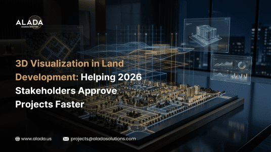
3D Visualization in Land Development: Helping 2026 Stakeholders Approve Projects Faster
In modern land development projects, delays are no longer driven by design limitations they are driven by slow stakeholder approvals.
Developers, civil engineers, and planning consultants often face:
Unclear 2D drawings
Misinterpretation across teams
Multiple revision cycles
Delayed investor or authority approvals
These inefficiencies result in extended timelines, increased costs, and lost opportunities.
3D visualization has emerged as a practical, results-driven solution helping stakeholders clearly understand project outcomes before execution begins.
Consider aligning your workflow with data-backed visualization and structured land development design to reduce uncertainty early in the process.
What is 3D Visualization in Land Development?
3D visualization converts:
CAD drawings
Survey data
Engineering plans
into accurate, realistic visual models.
This enables stakeholders to:
Visualize terrain, layouts, and infrastructure
Understand spatial relationships instantly
Make faster and more informed decisions
Unlike traditional drawings, 3D models provide clarity without technical complexity.
Well-structured models built on accurate land survey drafting data can significantly improve understanding and approval speed.
Why Stakeholder Approvals Are Often Delayed
Even well-designed projects face delays due to:
Lack of Visual Clarity
2D drawings fail to communicate real-world outcomes
Communication Gaps
Different teams interpret plans differently
Iterative Rework
Misalignment leads to repeated revisions
Slow Decision Cycles
Stakeholders hesitate without visual confidence
These challenges highlight a gap not in design, but in how projects are presented and understood.
Methods to Implement 3D Visualization
| Method | Description | Ideal Use Case |
|---|---|---|
| Static 3D Models | High-quality rendered visuals | Client presentations |
| Interactive Models | Explore designs dynamically | Stakeholder collaboration |
| BIM Integration | Data-rich engineering models | Large-scale projects |
| GIS-Based Models | Terrain & geospatial accuracy | Land planning |
Selecting the right approach depends on project complexity and stakeholder requirements.
Data Modeling Best Practices for Reliable Visualization
Effective 3D visualization is only as strong as the data behind it.
Key best practices include:
Using accurate survey and terrain data
Structuring CAD and design workflows properly
Maintaining consistent dimensions and relationships
Avoiding redundant or duplicate datasets
Aligning models with real-world constraints
These practices ensure technical accuracy and stakeholder trust.
Performance Optimization for Large Projects
For large-scale land development, performance plays a critical role.
Optimization strategies include:
Simplifying model complexity
Optimizing CAD-to-3D workflows
Using efficient rendering techniques
Structuring datasets for faster processing
Optimized models lead to faster load times, smoother interaction, and better user experience.
Real-World Applications in the United States
3D visualization is widely used across:
Residential Developments → Plot layouts, amenities
Commercial Projects → Infrastructure planning
Land Subdivision → Approval simplification
Infrastructure Projects → Roads, drainage, utilities
These use cases demonstrate how visualization enables faster and more confident decision-making.
When to Consider Professional Support
Professional expertise becomes essential when:
Projects involve multiple stakeholders
Accuracy and presentation quality are critical
Large datasets and complex terrain are involved
Faster approvals are a priority
Planning a complex land development project?
Working with teams experienced in land development design and land survey drafting support can help streamline both execution and approvals.
The Future of Land Development Visualization
Looking ahead, the industry is moving toward:
AI-driven modeling
Real-time visualization
Cloud-based collaboration
Integrated smart planning systems
The focus is shifting toward speed, clarity, and data-driven decisions.
Conclusion
In today’s competitive landscape, faster approvals are not just an advantage they are a necessity.
3D visualization enables organizations to:
Improve stakeholder communication
Reduce project delays
Enhance planning accuracy
Deliver more predictable outcomes
However, the true impact of visualization depends on the strength of the underlying design and data workflows.
Organizations that combine precise land survey drafting with structured land development design are better equipped to deliver reliable, approval-ready models that stakeholders can trust.
This integrated approach is increasingly being adopted by firms that prioritize accuracy, efficiency, and scalable project execution ensuring that visualization is not just a presentation tool, but a strategic asset in project delivery.